Site Plan for Townhouses
(Rosedale)
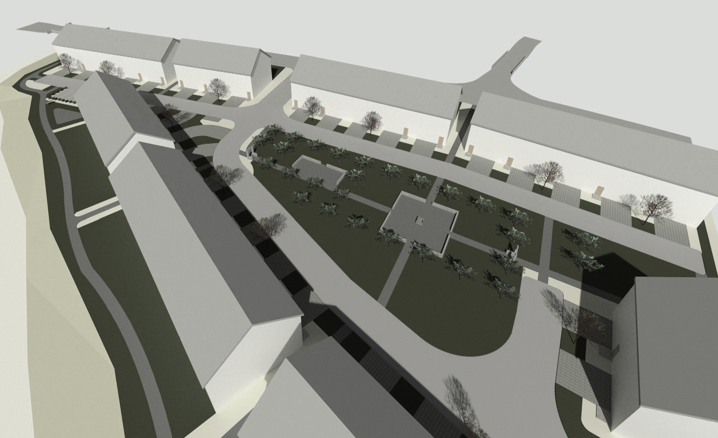
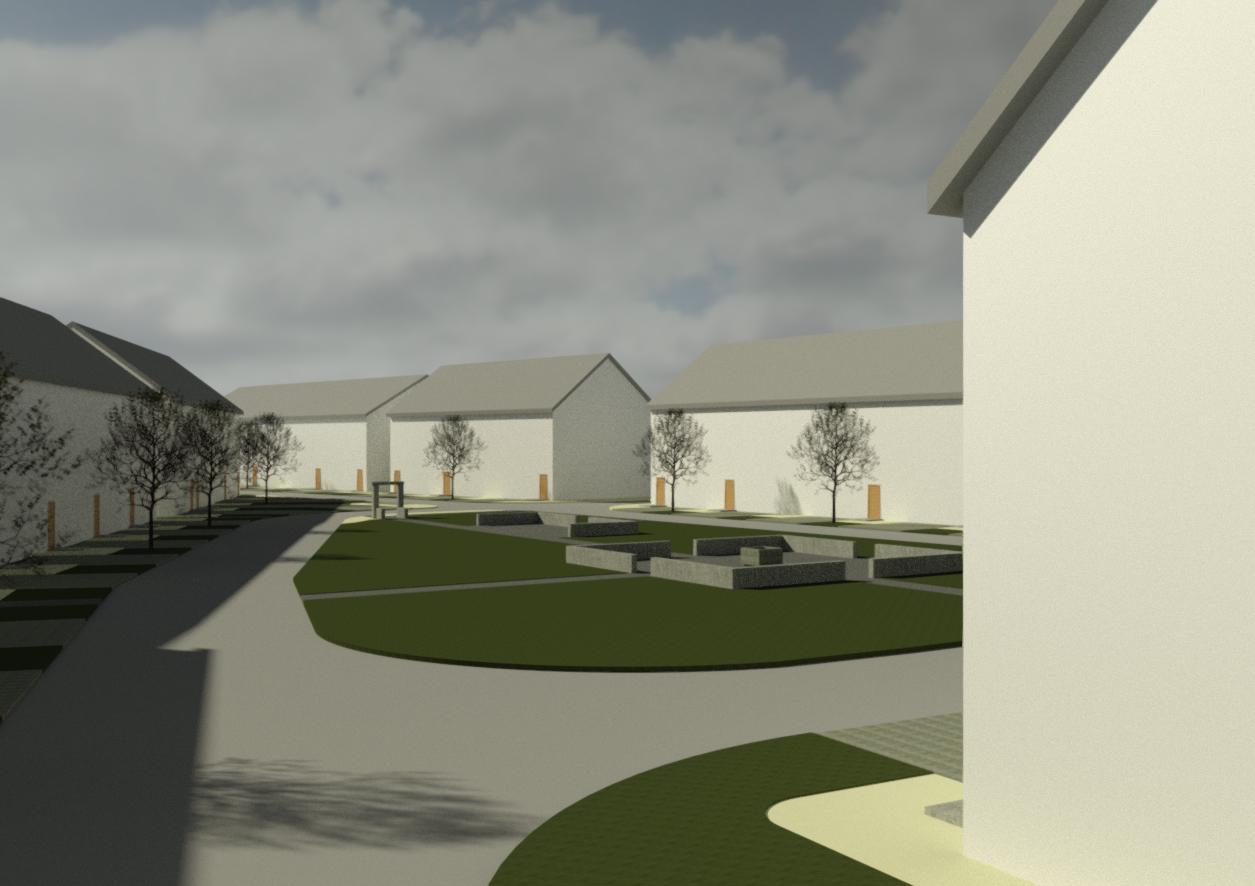
This triangle lot border's the small town of Rosedale. Historically the town was a stopping point for settlers travelling along Yale Road from the BC coast to the interior, and in the further past, evidence can be found of first nation camps taking rest in the slow tributaries that meander through the area as they paddle up the Fraser River. Today this lot marks a distinct boundary between surrounding agricultural land and the beginnings of residential zone associated with Rosedale. Because it's distance from the central business area, there is a lack of city infrastructure to the site, particularly a sewage connection. In order to make a viable townhouse site, some of the lot area needed to be reserved to process the housing outflows through a septic field system. This large central area on the site created a distinct courtyard for the prospective community members to engage in. Modelled after the courtyards of European monasteries, the landscape is centered on well-like structure, a meeting place surrounded by a grid of small apple trees. The large setback from the bordering water-way also allowed for a small walking trail again fostering a sense of community within the complex. While the buildings along north portion of the site provide a front to Yale Road, the rear buildings will enjoy pastoral views of fields reserved for agriculture.


 (1/4)
(1/4)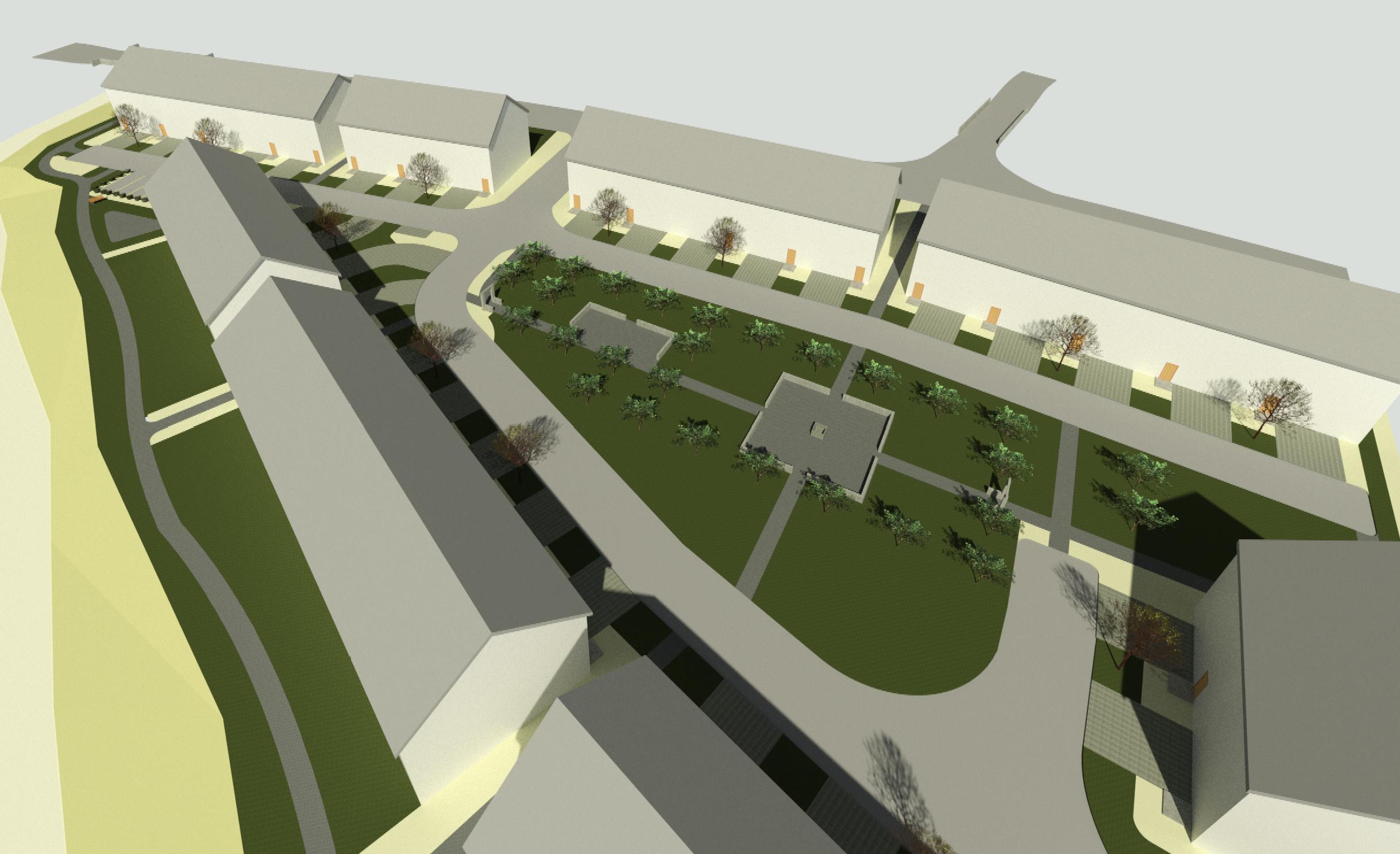 (2/4)
(2/4)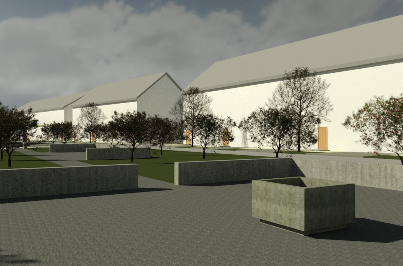
(3/4)
(4/4)
Feasbility Study for City Hall
(Chilliwack)
in collaboration with CHP Architects:
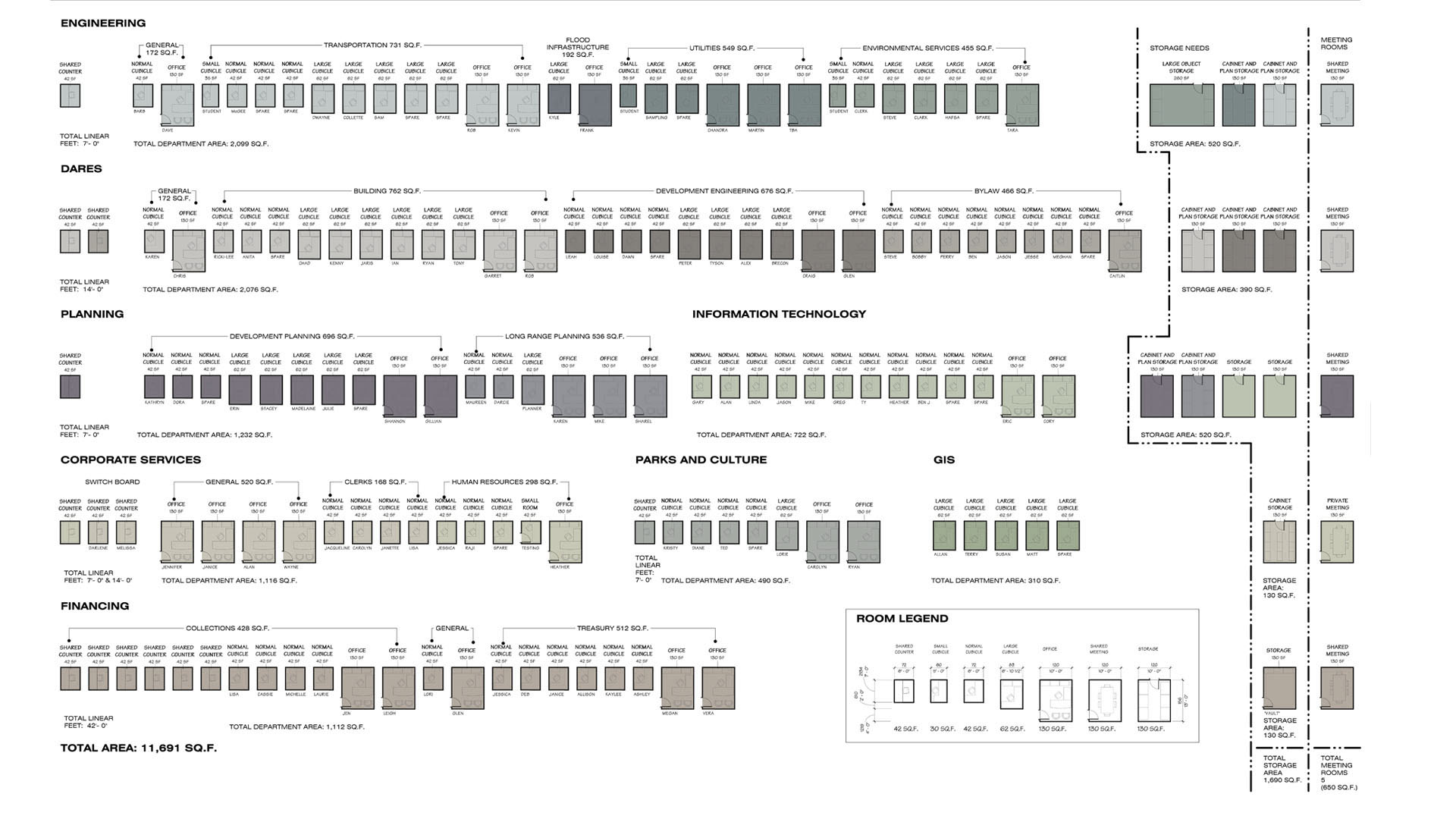
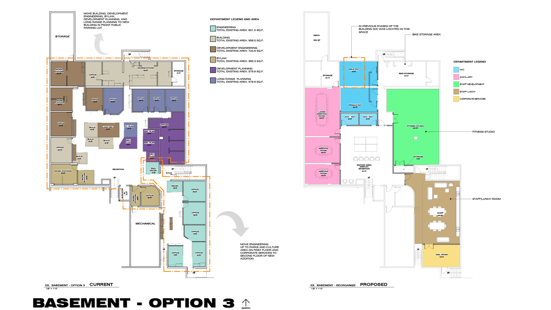
This project provided spatial analysis for the City of Chiliwack's administrative building. By carefully studying the different area requirements of each department and how they interacted with the public, a number of different options were proposed by shifting departments within and out of the building. Future design concepts and site planning were also an important part of the project determining how the city would move forward in future
This project provided spatial analysis for the City of Chiliwack's administrative building. By carefully studying the different area requirements of each department and how they interacted with the public, a number of different options were proposed by shifting departments within and out of the building. Future design concepts and site planning were also an important part of the project determining how the city would move forward in future


 (1/9)
(1/9)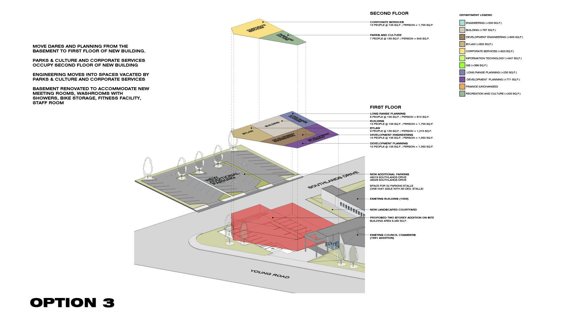 (2/9)
(2/9)
(3/9)

(4/9)
 (5/9)
(5/9) 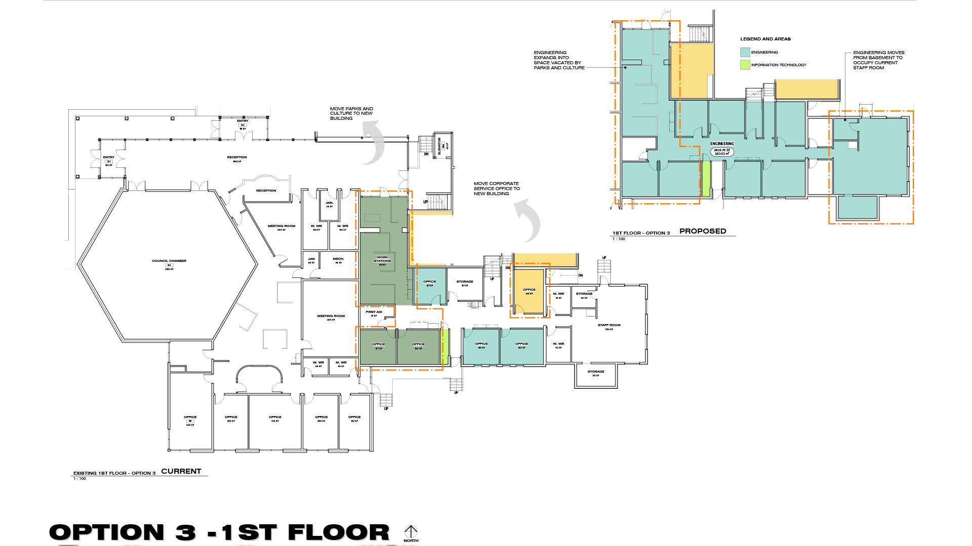 (6/9)
(6/9)  (7/9)
(7/9) (8/9)
(8/9) 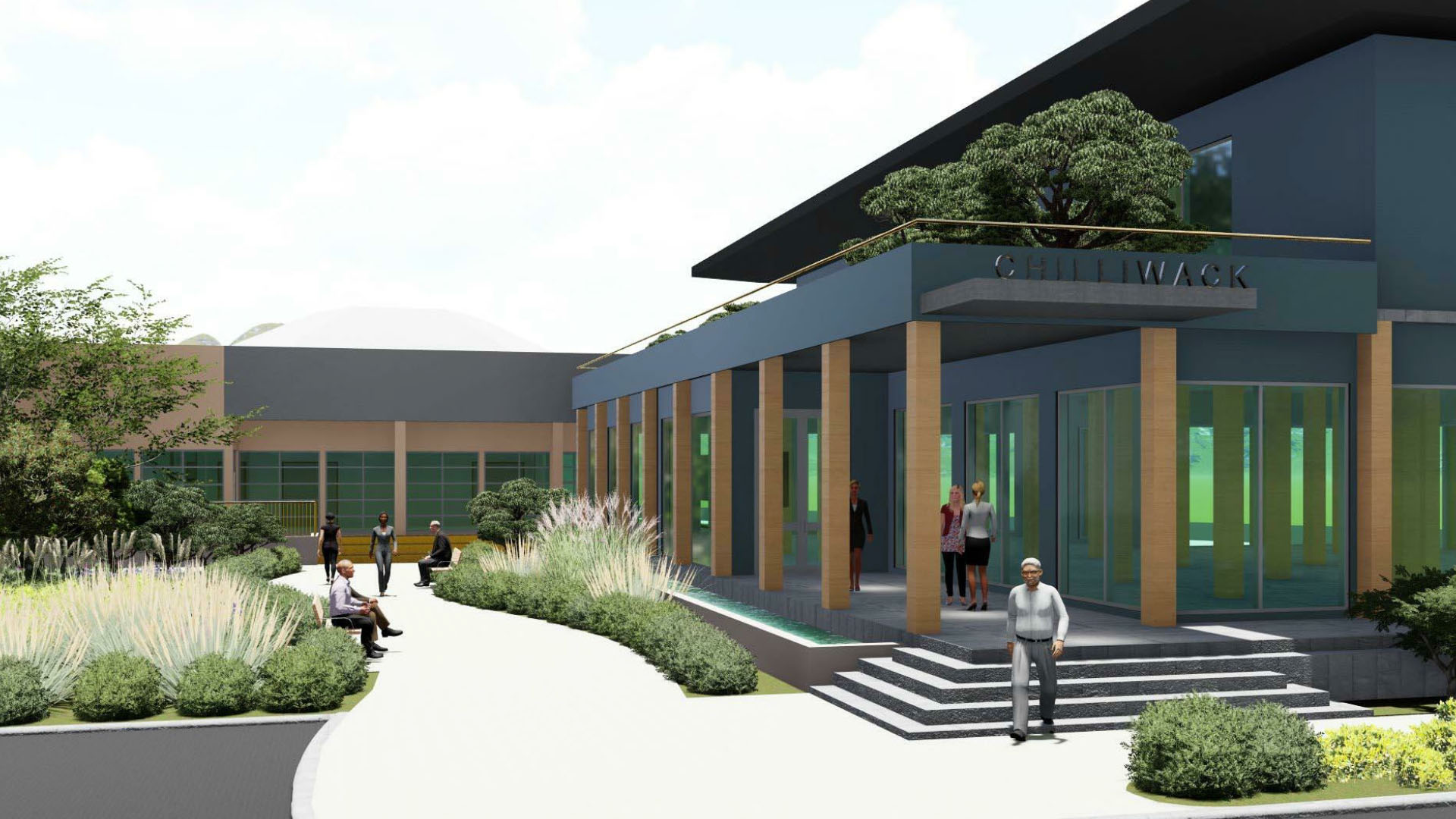 (9/9)
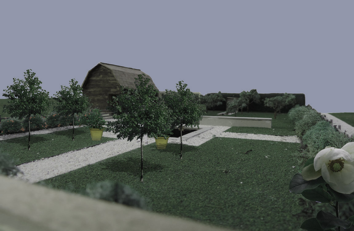
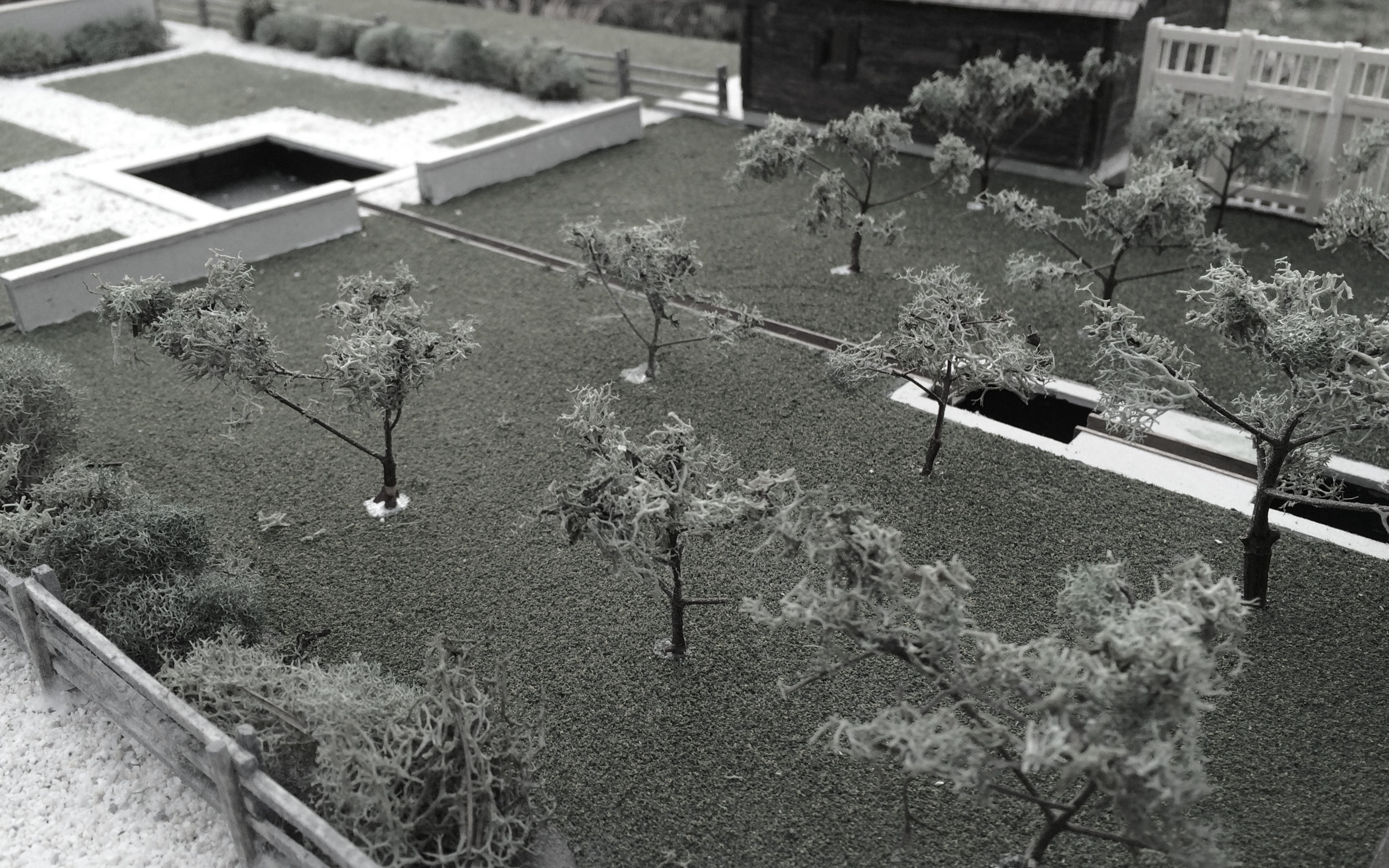
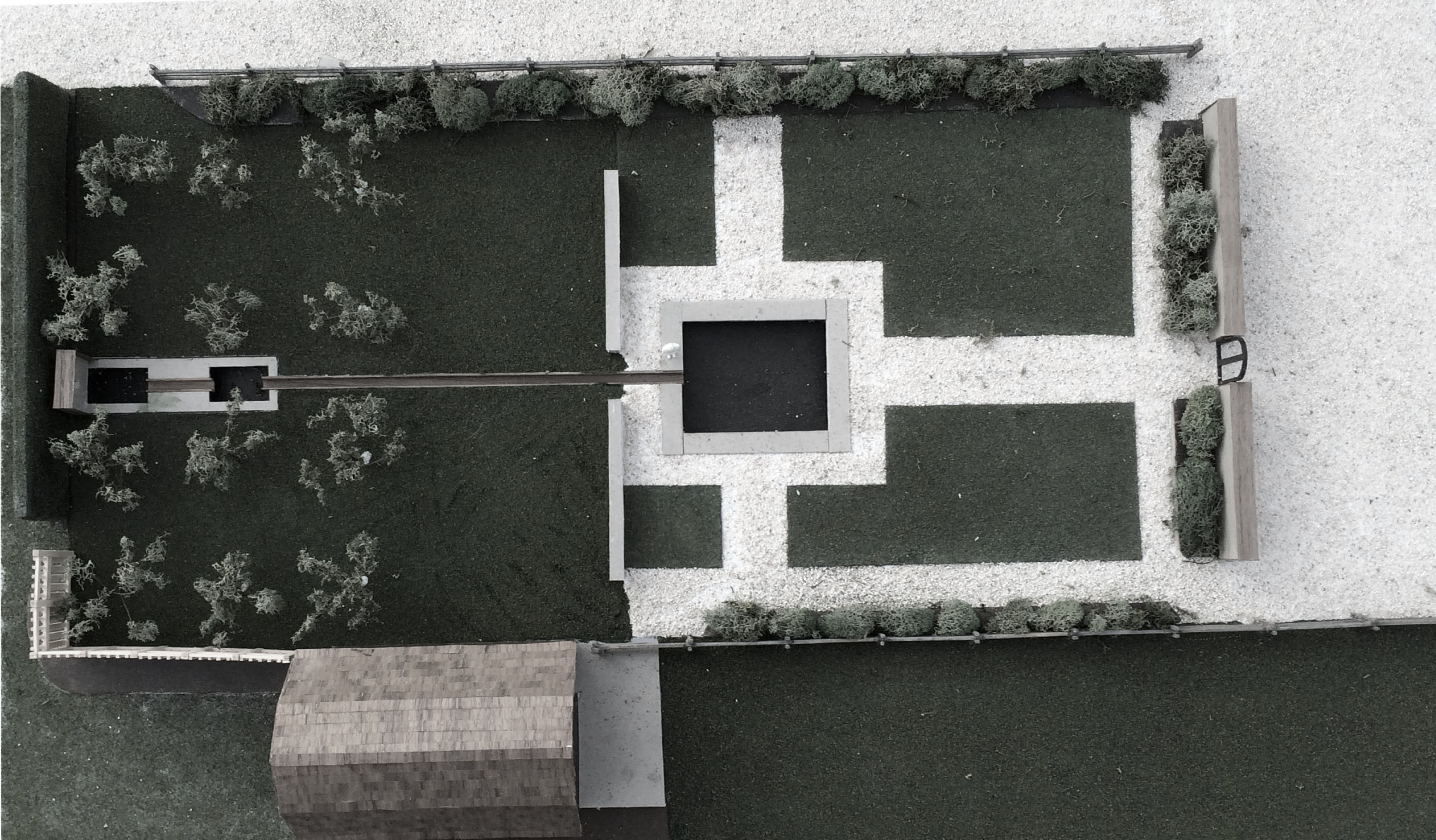
(9/9)Garden
(Camp River Road)
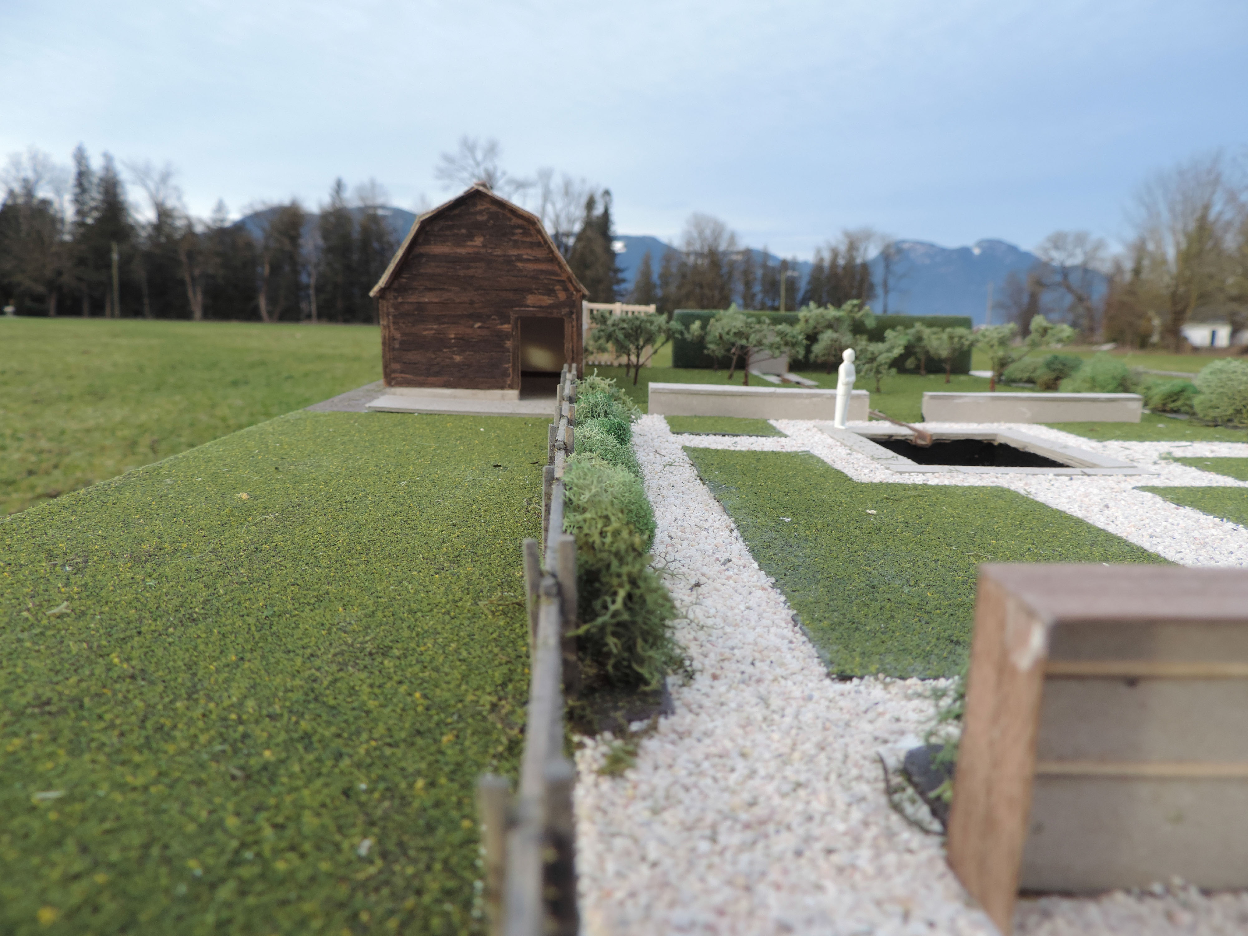
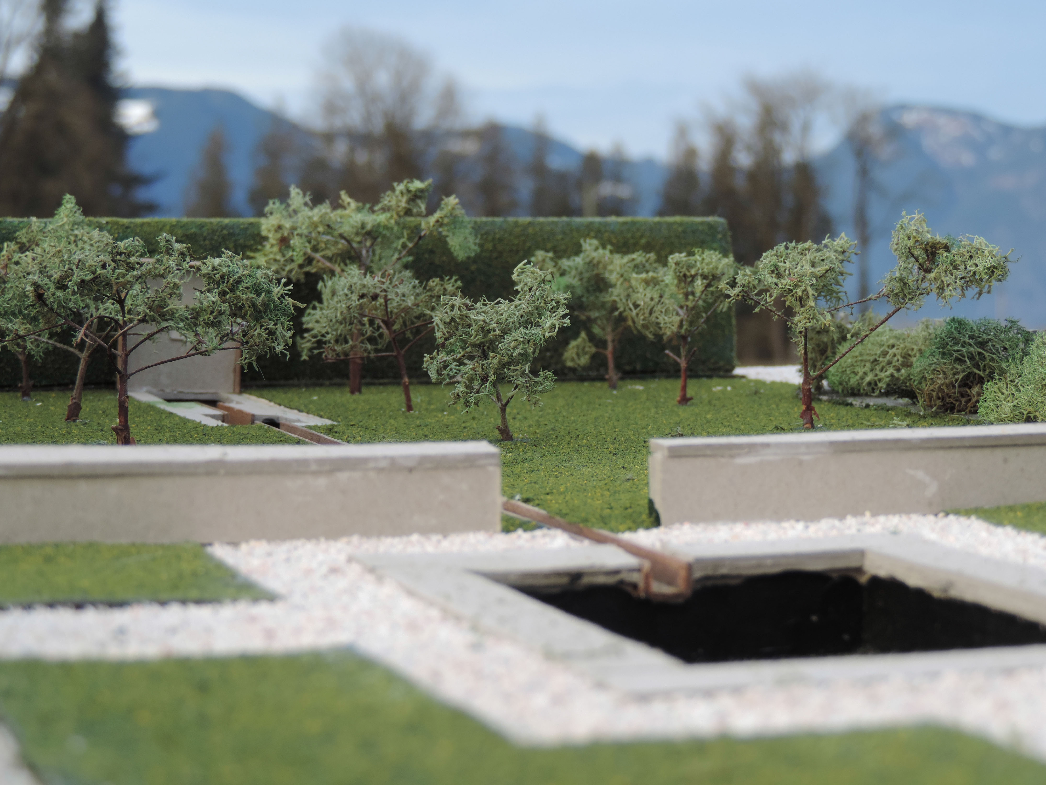
A small garden project, initiated by the construction of the model, is based off the grid system associated with agriculture activity and the classical ideal of a visual axis running through rooms. The process of pumping water up through the two rock pits at the north end of the garden assures that water maintains clarity and cleanliness through out the seasons.


 (1/9)
(1/9)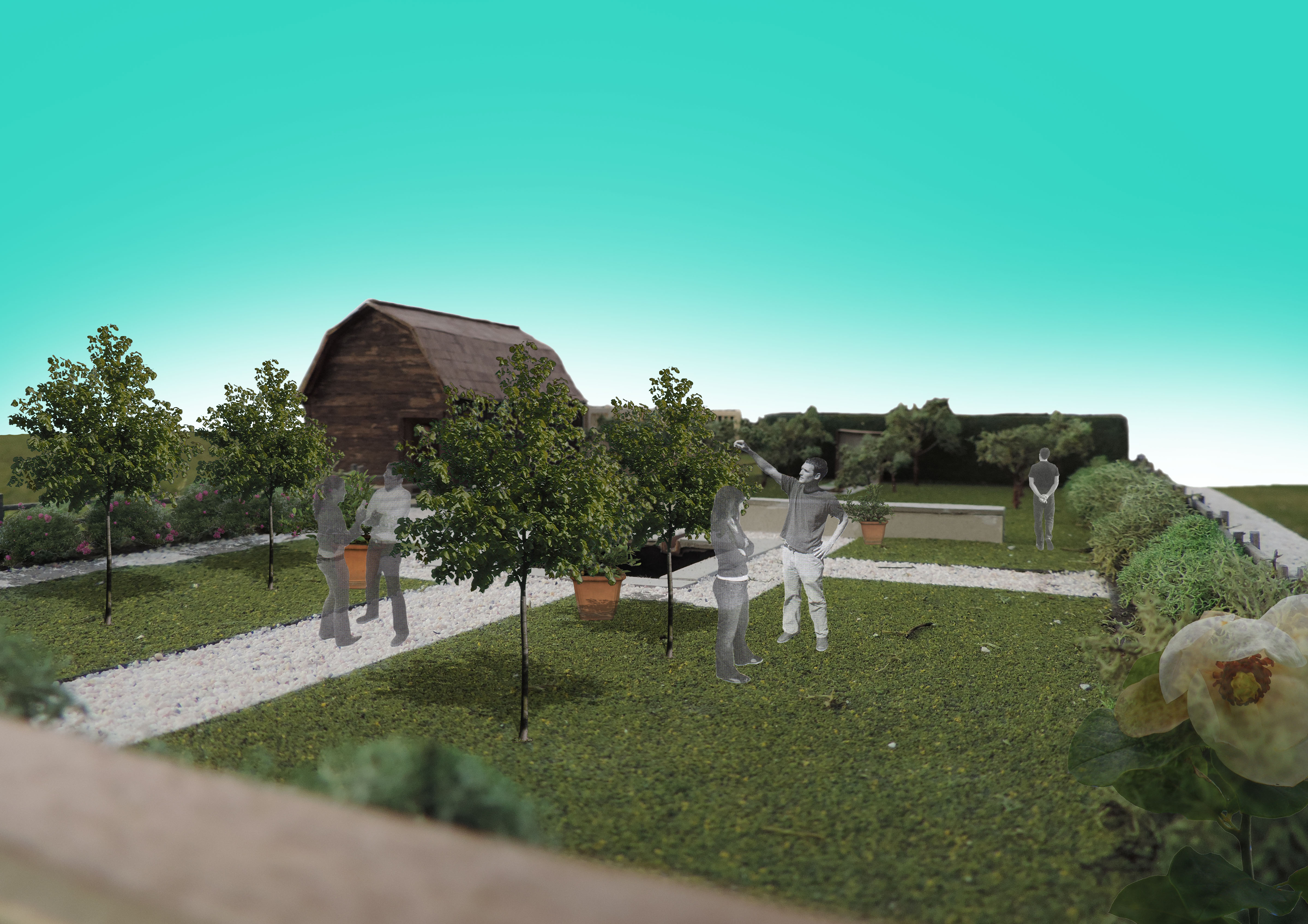 (2/9)
(2/9)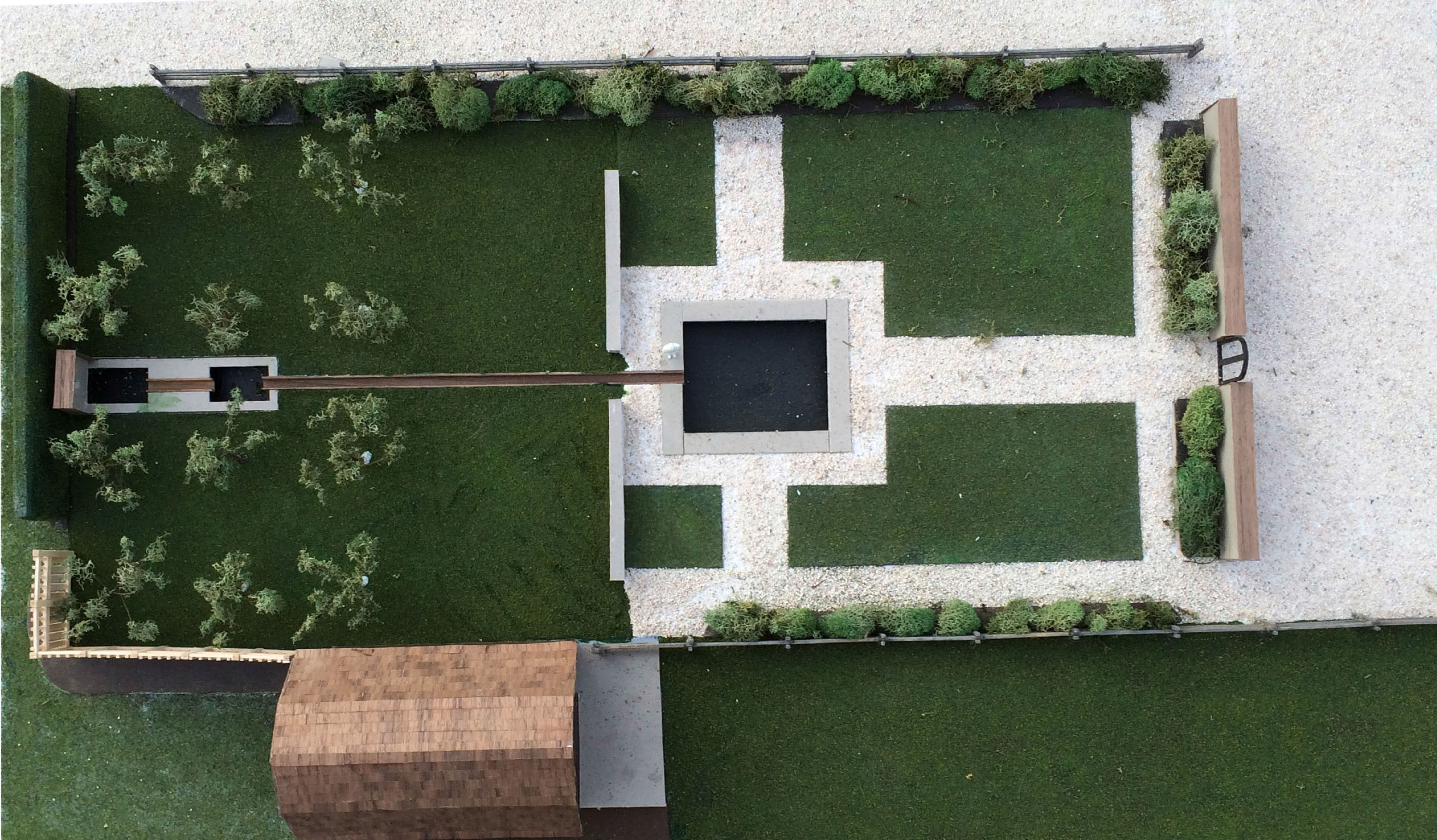
(3/9)
(4/9)
 (5/9)
(5/9)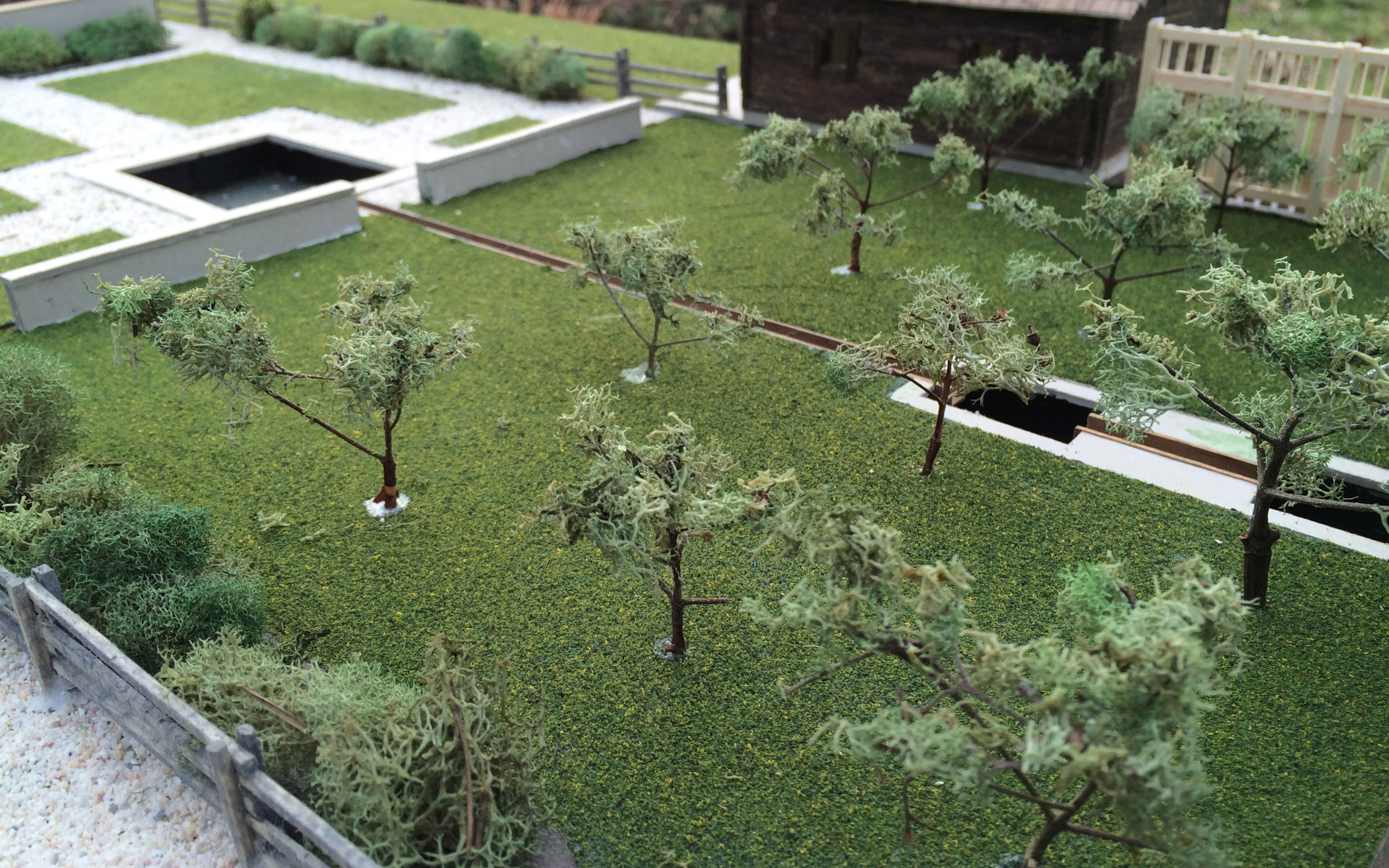 (6/9)
(6/9)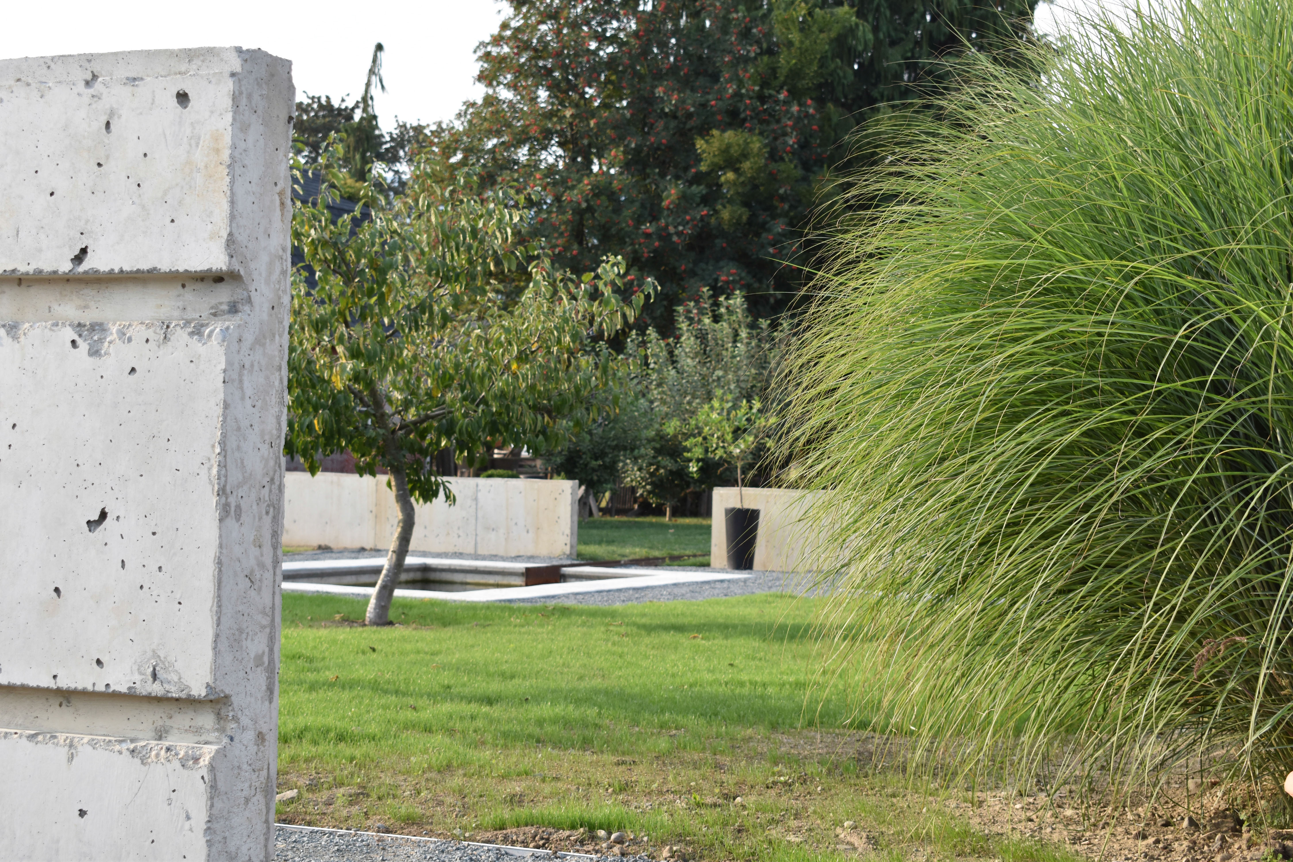 (7/9)
(7/9) (8/9)
(8/9) (9/9)
(9/9)